The database was generated by extracting satellite images from Google Earth.
We extracted 120 high-resolution color images acquired in the visible spectrum from ten different places:
Berlin (Germany), Buenos Aires (Argentina), Foz do Iguaçu (Brazil), London (Canada), Hong Kong (China), London (England), Venice (Italy), Warsaw (Poland), New York (United States) and District of Columbia (United States).
In such case, we guarantee that images from same class could be acquired by different satellites, with different illuminations, colors and textures.
For each one of the ten places, we chose three points for image extraction .
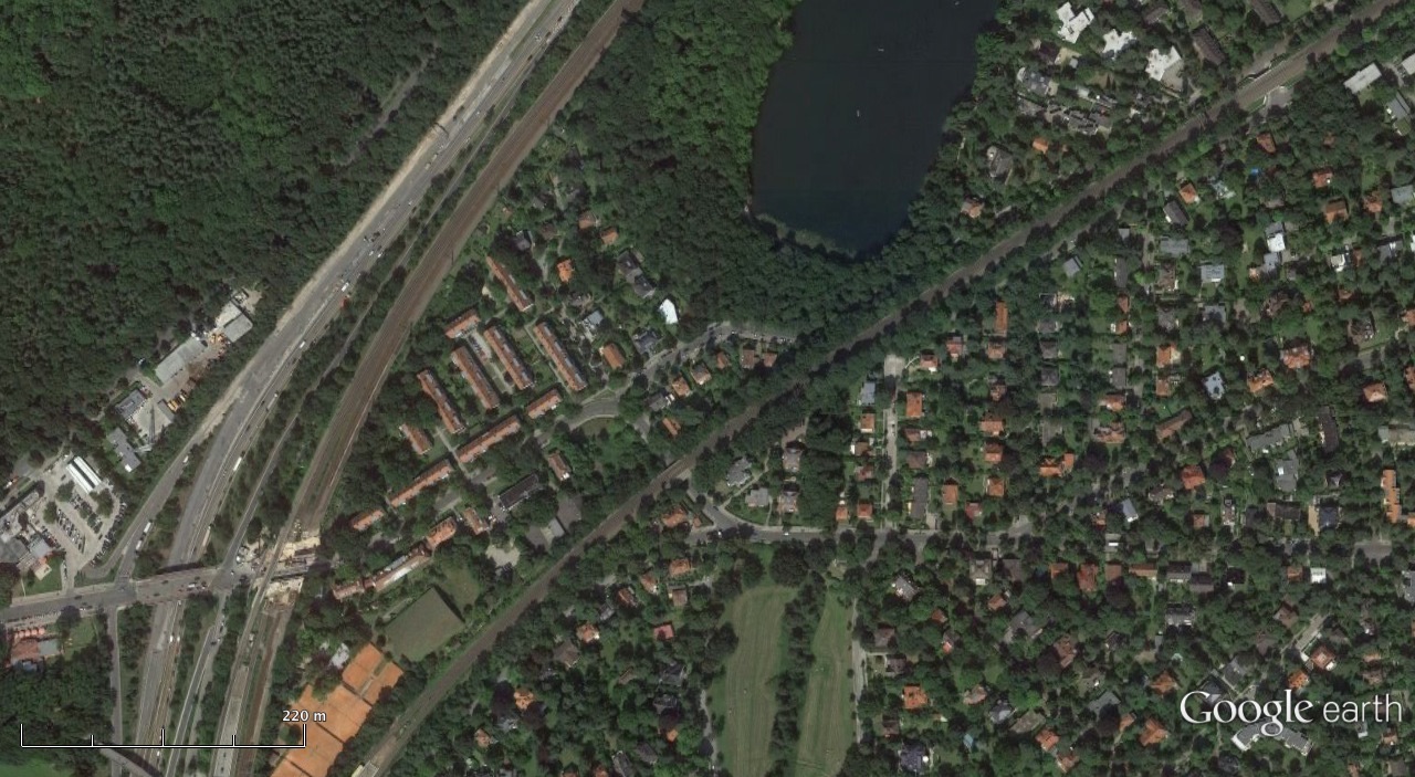
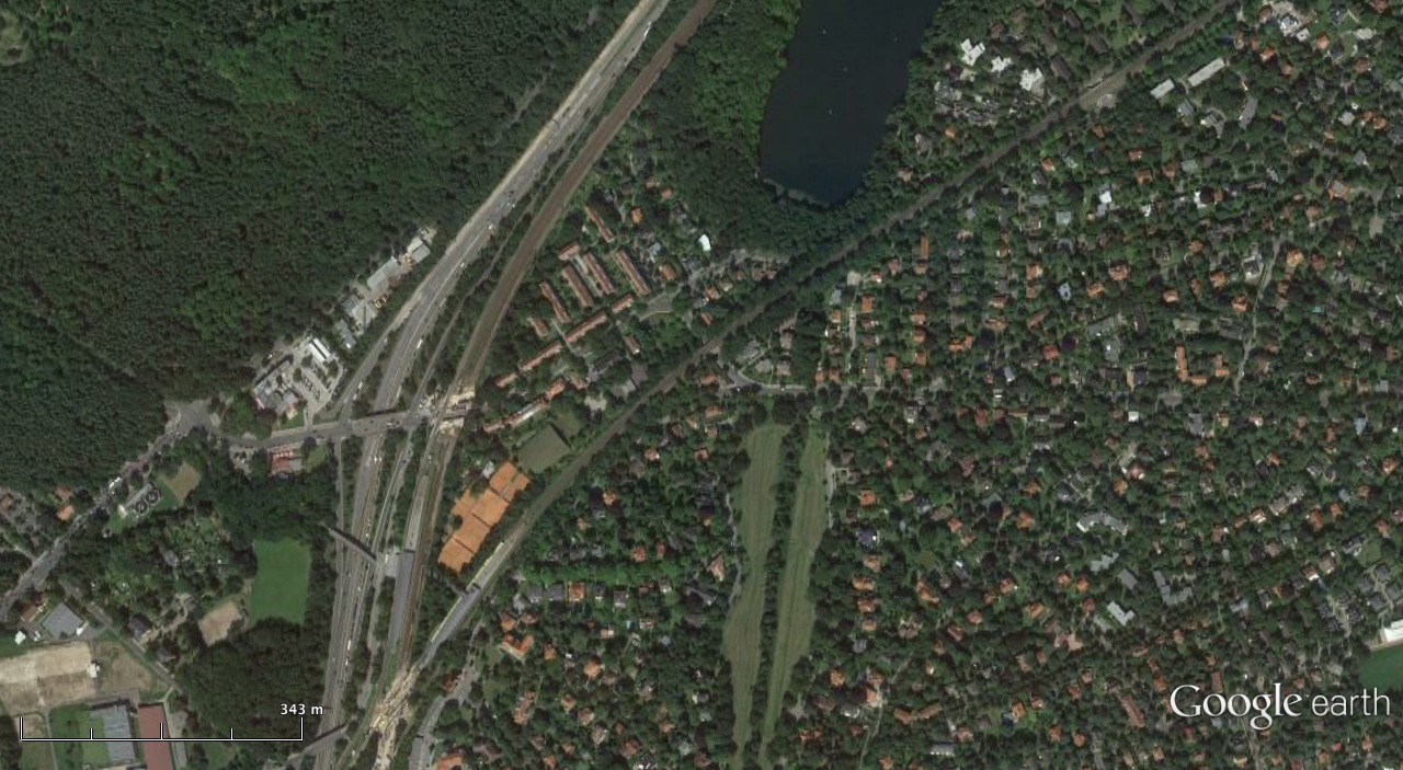
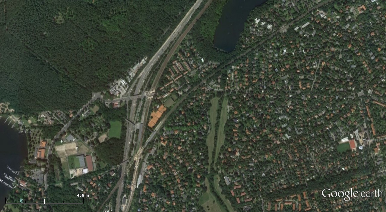
For each selected point, we extracted four images from four selected altitudes (500m, 1000m, 1500m and 2000m), allowing images in different scales.
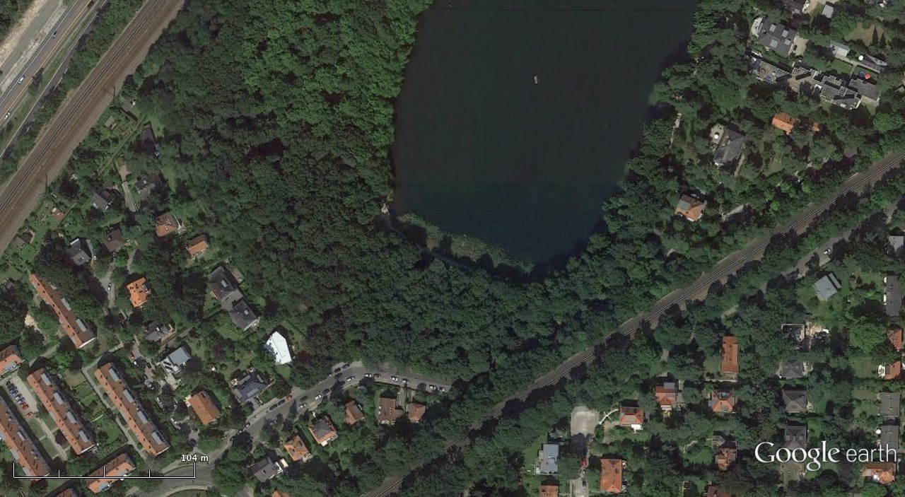
Each image has, at least, color pixels from four predefined classes (tree, soil, street and water), at a resolution of 1280 x 580 pixels in TIFF format without image compression. An example is shown in Figure 1.
| |
|
|
|
| a) | b) | c) | d) |
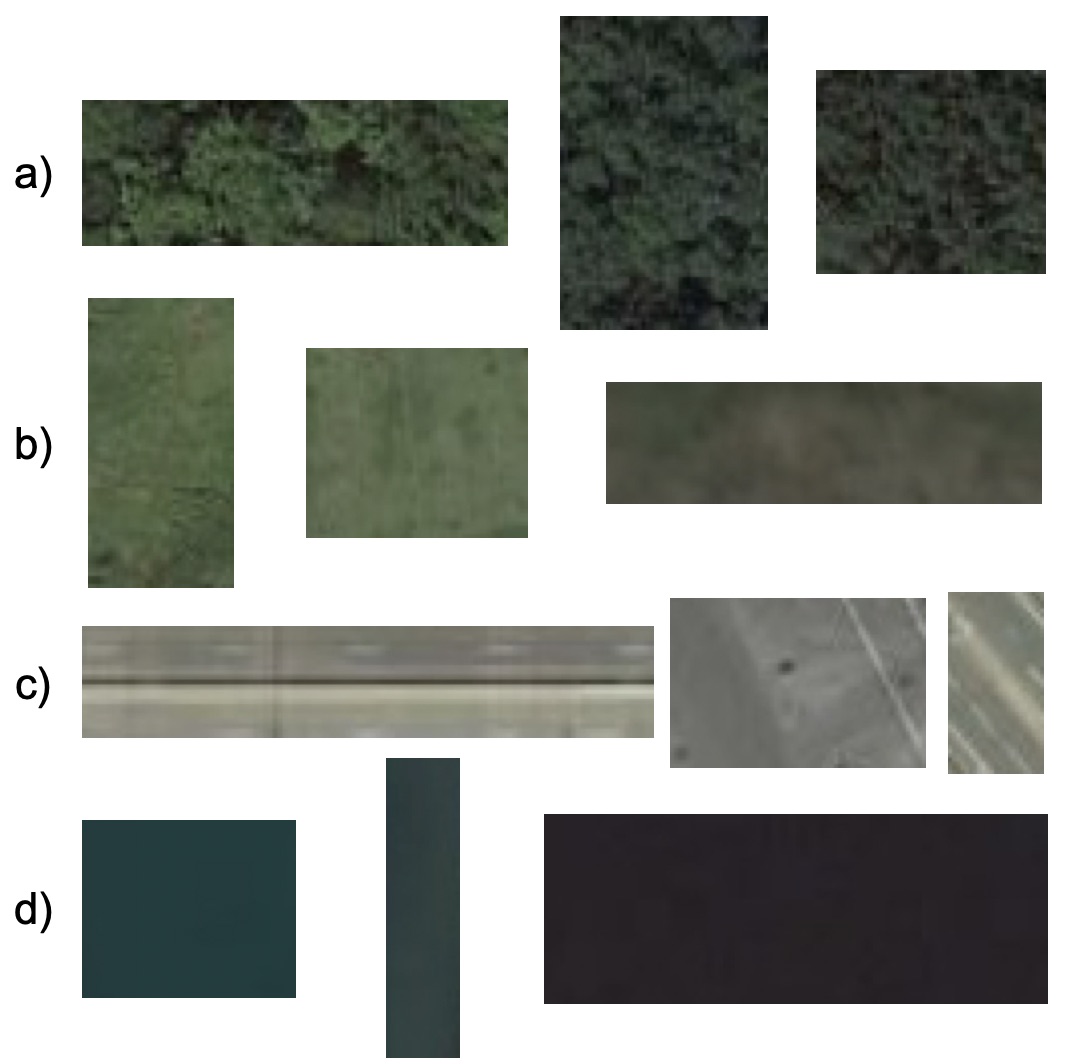
For each image in each scale, we cropped different image slices in different sizes, for each defined class.
Figure 2 shows some examples of such image slices.
 |
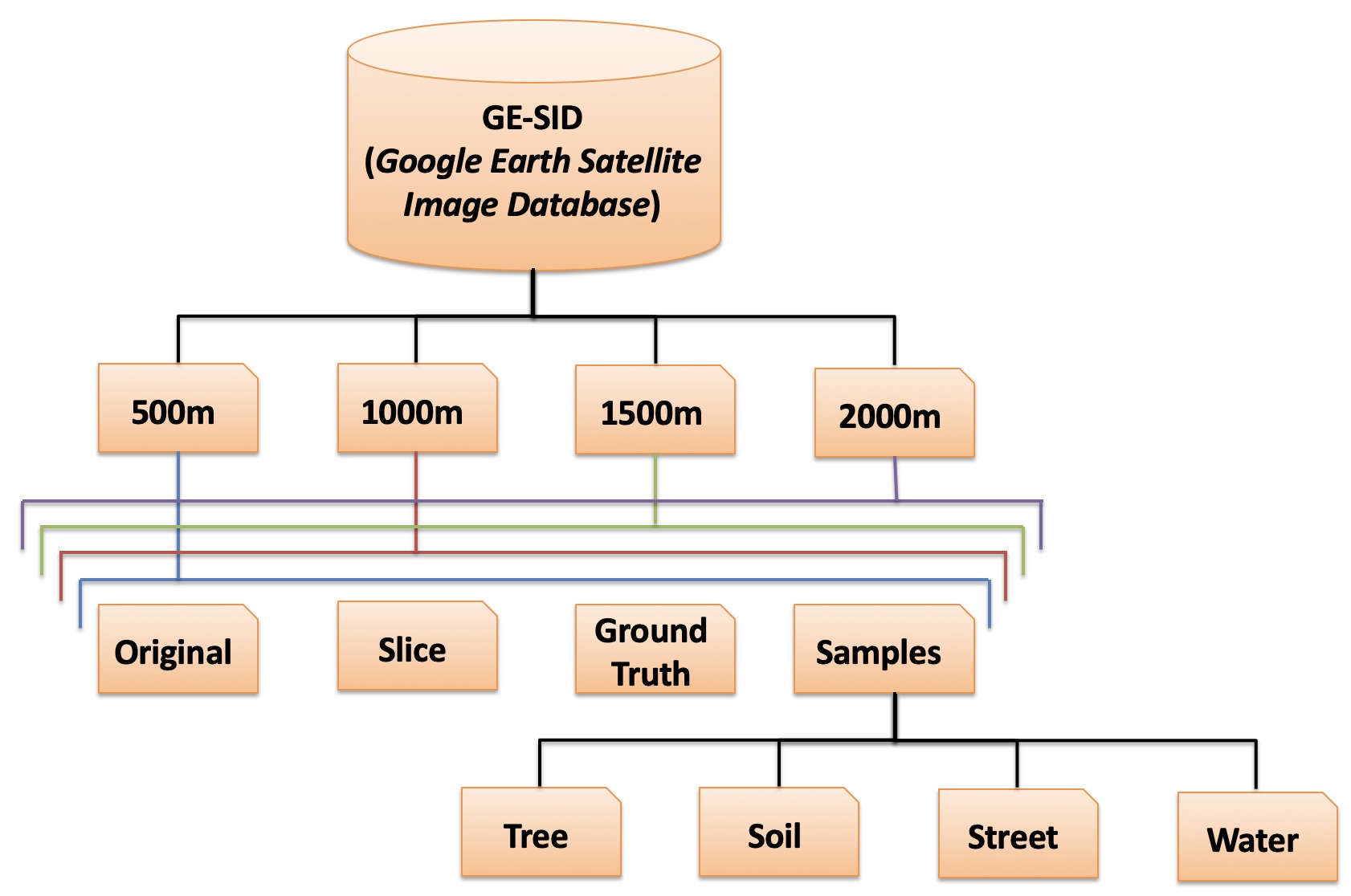
The structure of the database can be seen in Figure 3. We call this database as GE-SID (Google Earth Satellite Image Database).
 |
For each scale we computed the total number of pixels from all the image slices.
Table I shows the number of samples (individual pixels) for each class (Tree, Soil, Water and Street) according to the image altitude or scale (500m, 1000m, 1500m, 2000m).
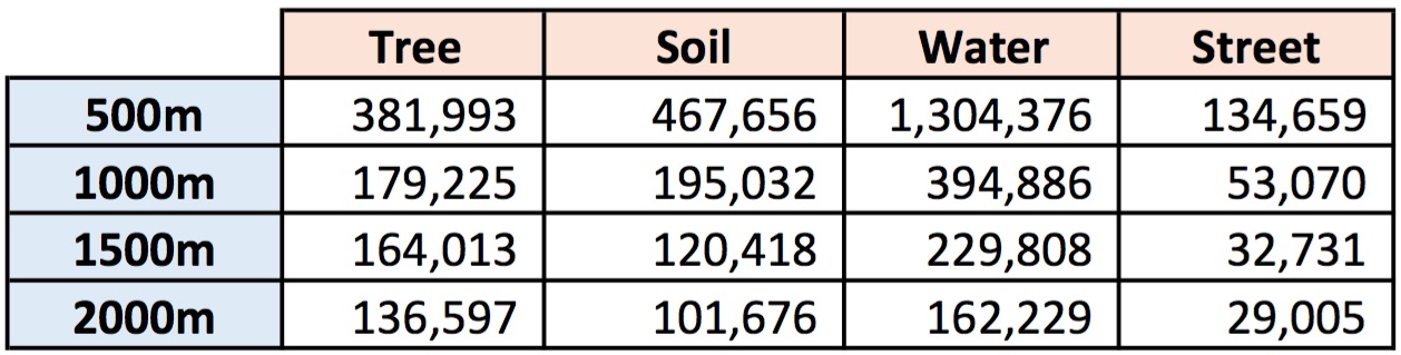 |
There is a total of samples:
The more high is the altitude, the smaller are the objects in the image, and more difficult is to select the pixels corresponding to each class by naked eye, because the objects are very small generating doubts to which class they belong.
The dataset is available for download as .zip file (~ 393 MB):
click here: GE-SID (Google Earth Satellite Image Database)
If you use this satellite dataset in your research, please consider mentioning the following paper:
MORAES, D. R.; GONZAGA, A. Multi-class Segmentation of Satellite Images by Color Mixture and Neural Network, Anais do XIII Workshop de Visão Computacional, 30 de outubro a 01 de novembro, 2017, Natal, RN, Brasil, pp. 59-64. ISBN: 978-85-425-0775-1.